
Ultimate Guide to Zinave Safari
Find Zinave Safari Tours from Verified Mozambique Operators
The Ultimate Guide to Zinave Safari
Magnificent Mozambique National Parks
Zinave National Park (Parque Nacional do Zinave) lies in Mabote District of Inhambane Province, Mozambique. Spanning 4,000 square kilometres south of the Save River, it was officially proclaimed on 26 June 1973. The park’s landscapes bridge the wetter tropics of the southeast with the drier savannahs of the interior, creating a distinctive ecological transition zone.
History
The area first gained recognition in 1962 as a hunting concession managed by Mozambique Safariland. A decade later, it was elevated to national park status. Unfortunately, decades of neglect and the Mozambican Civil War left Zinave stripped of much of its wildlife. By 2010, many iconic species had vanished due to relentless poaching. A turning point came in 2017 when 6,000 animals were donated for translocation, marking the beginning of a large‑scale rehabilitation effort aimed at restoring Zinave’s ecological richness.
Ecology
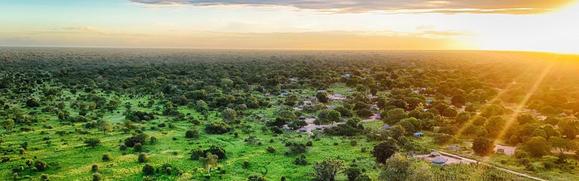
The park’s terrain slopes gently from 174 metres in the southeast down to 110 metres at the Save River. Seasonal pans punctuate the sandy soils, while clay deposits line the riverbanks. Vegetation is diverse: riverine forests with tall canopies, acacia woodlands, mopane thickets, sandveld open woodlands, and miombo landscapes with wetlands and grasslands. Each zone supports different ecological communities, making Zinave a mosaic of habitats well suited for wildlife recovery.
Wildlife
Historically, Zinave was home to elephants, giraffes, rhinos, buffalo, wildebeest, zebras, and predators like cheetahs and hyenas. Civil war and poaching nearly erased these populations. Today, thanks to reintroduction programs, antelopes, buffalo, and elephants are returning. The park’s varied vegetation and seasonal pans provide the food and shelter needed to rebuild healthy populations.
Surrounding Areas
Zinave forms part of the Great Limpopo Transfrontier Park, linking Mozambique’s Banhine and Limpopo parks with Kruger National Park in South Africa and Gonarezhou in Zimbabwe. This vast conservation corridor strengthens ecological connectivity and allows wildlife to migrate across borders. The Save River acts as a natural boundary, while nearby communities continue subsistence farming within the park’s buffer zones.
Activities
Game Drives: Explore mopane forests and miombo grasslands while spotting reintroduced wildlife.
Birdwatching: The park’s wetlands and woodlands attract a wide variety of bird species.
Hiking: Trails through sandveld and riverine forests reveal diverse landscapes.
Cultural Encounters: Learn from local communities about traditional farming and medicinal plant use.
Photography: Capture seasonal pans, regenerating forests, and wildlife returning to the park.
Best Time to Visit
Dry Season (May–October): Easier access and excellent wildlife viewing near pans and rivers.
Wet Season (November–March): Lush greenery and active birdlife, though roads may be difficult.
Transitional Months (April, early November): Balanced conditions with fewer visitors and vibrant scenery.
Visitor Tips
Access: Reachable via Mabote District, with links to other parks in the Great Limpopo network.
Vehicles: A 4x4 is essential for sandy tracks and seasonal pans.
Supplies: Bring food, water, and essentials, as facilities are limited.
Clothing: Light wear for hot days, sturdy boots for trails, and rain gear in wet months.
Safety: Follow park rules, respect wildlife, and travel with guides.
Community Support: Engage with local initiatives to support sustainable farming and conservation.