
Ultimate Guide to Bwindi Safari
Find Bwindi Safari Tours from Verified Uganda Operators
The Ultimate Guide to Bwindi Safari
Bwindi SafariBwindi Impenetrable National Park, located in southwestern Uganda along the border with the Democratic Republic of the Congo, is one of Africa’s most celebrated ecological treasures. It lies adjacent to Virunga National Park and sits on the edge of the Albertine Rift, covering an area of 321 km² (124 sq mi). The park is composed of dense lowland and montane forest, accessible only by foot, which adds to its mystique and sense of adventure. Recognized as a UNESCO World Heritage Site, Bwindi is renowned for its extraordinary biodiversity and its role as a sanctuary for endangered species, most notably the mountain gorilla.
Species Diversity
Bwindi is often described as one of the richest ecosystems in East Africa.
Mammals: Over 120 species, including primates such as colobus monkeys and chimpanzees.
Birds: More than 350 species, ranging from hornbills to turacos.
Butterflies & Reptiles: 310 butterfly species, plus frogs, chameleons, and geckos.
Flora: Over 1,000 flowering plants, 200 tree species, and 104 ferns. The northern sector is home to rare Guineo-Congolian flora, including endangered species like brown mahogany and Brazzeia longipedicellata.
This incredible diversity is partly due to the park’s varied elevations and habitats, making it a hotspot for endemism within the Albertine Rift.
Mountain Gorillas
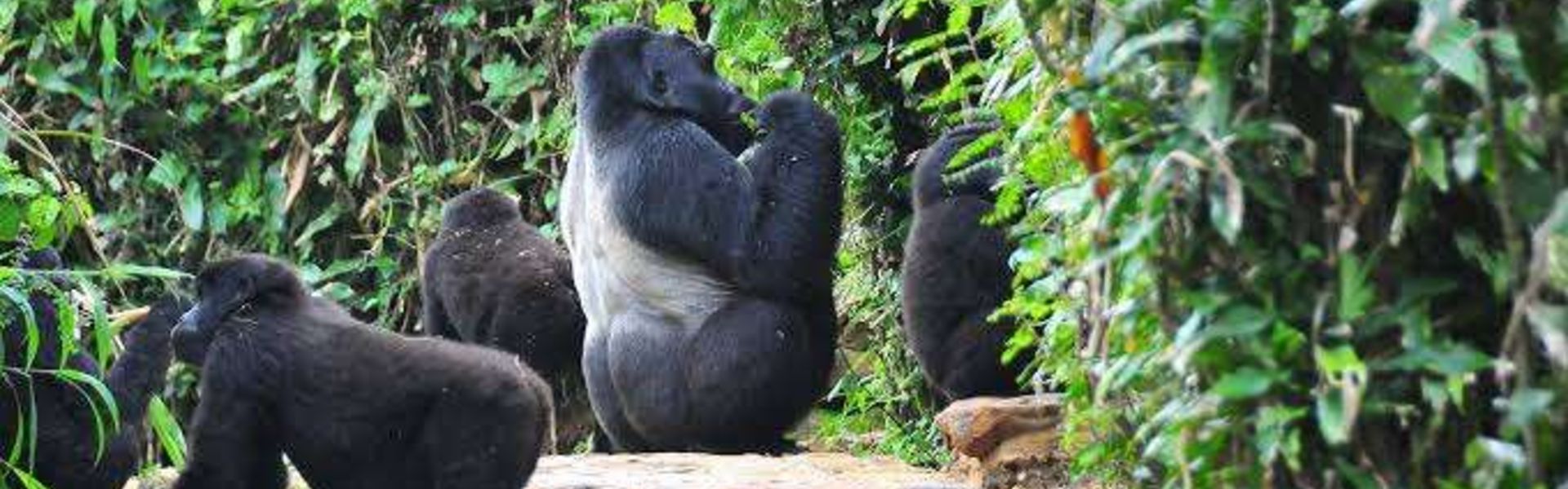
Bwindi is most famous for its population of mountain gorillas (Gorilla beringei beringei). With around 400 individuals, the park hosts nearly half of the world’s remaining mountain gorillas. Fourteen habituated groups live across four sectors: Buhoma, Ruhija, Rushaga, and Nkuringo. Gorilla tracking, introduced in 1993, has become one of Uganda’s most iconic tourism experiences.
Censuses over the years show steady growth:
1997: ~300 gorillas
2006: ~340 gorillas
2018: 459 gorillas across 36 social groups
Despite this progress, threats such as poaching, disease, and habitat loss remain significant.
History
1932: Two forest blocks designated as Crown Forest Reserves.
1942: Combined into the Impenetrable Central Crown Forest.
1964: Declared an animal sanctuary to protect gorillas.
1991: Elevated to national park status, renamed Bwindi Impenetrable National Park, and later inscribed as a UNESCO World Heritage Site in 1994.
2003: Expanded with an additional 4.2 km² of land.
The park’s creation had profound impacts on local communities, especially the Batwa people, who were evicted and denied access to ancestral lands and resources.
Geography & Climate
Bwindi lies within the rugged Kigezi Highlands at the edge of the Western Rift Valley.
Elevation: Ranges from 1,190 m to 2,607 m, with 60% of the park above 2,000 m.
Topography: Steep hills, narrow valleys, and a dense network of rivers.
Hydrology: Acts as a vital water catchment, feeding rivers such as the Ivi, Munyaga, and Ishasha, which flow into Lake Edward and other nearby lakes.
Climate: Tropical, with temperatures between 7–27 °C and annual rainfall of 1,400–1,900 mm. Rain peaks occur March–April and September–November.
The forest regulates local climate, reduces soil erosion, and ensures water availability during dry seasons.
Biodiversity Highlights
Bwindi’s forest is ancient, biologically complex, and considered a refuge for species during past climatic shifts.
Vegetation: Afromontane forest, rare in Africa, with over 220 tree species.
Fauna: 120 mammal species, including chimpanzees, elephants, L’Hoest’s monkeys, and giant forest hogs.
Birdlife: Over 350 species, including the African green broadbill.
Butterflies: More than 200 species, including the cream-banded swallowtail.
A 2025 census revealed 426 chimpanzees living in the park, further underscoring its importance for primate conservation.
Conservation & Community Challenges
Bwindi is managed by the Uganda Wildlife Authority and enjoys full protection. However, surrounding communities face poverty and high population density (over 300 people per km²), leading to pressure on the forest.
Before 1991: Locals hunted, logged, mined, and harvested honey in the forest.
After 1991: Access was cut off, causing resentment and conflict. The Batwa, who had lived sustainably in the forest for generations, were evicted without compensation, unlike non-Batwa farmers who received land rights.
Tourism has brought economic benefits but also challenges, such as gorillas raiding crops due to reduced fear of humans. Armed guards now accompany tourist groups to ensure safety.
Activities
Gorilla Tracking: The park’s signature experience, offering close encounters with mountain gorillas.
Birdwatching: Spot rare Albertine Rift endemics.
Nature Walks: Explore waterfalls, rivers, and forest trails.
Cultural Tours: Engage with local communities, including Batwa heritage experiences.
Photography: Capture misty forests, wildlife, and dramatic landscapes.
Best Time to Visit
Dry Seasons (June–August, December–February): Best for gorilla tracking and hiking, with easier access and clearer skies.
Rainy Seasons (March–May, September–November): Forests are lush and atmospheric, but trails are muddy and more challenging.
Visitor Tips
Always book gorilla permits in advance through Uganda Wildlife Authority.
Carry waterproof clothing, sturdy hiking boots, and insect repellent.
Travel with guides or rangers for safety and navigation.
Respect wildlife and cultural sensitivities, especially regarding the Batwa communities.